(Graphics: National Weather Service)
Here comes snow.
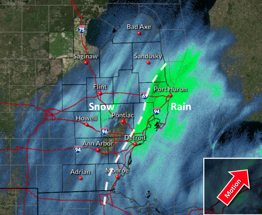
A low-pressure system is brings snowfall Monday morning, with accumulations in Southeast Michigan of two to three inches.
The National Weather Service posts a winter weather advisory from 3 p.m. Monday until noon Tuesday for Oakland, Macomb, Washtenaw, Wayne, Lenawee and Monroe counties.
Things start getting tricky around 6 p.m., when snow is expected to start accumulating on roads, possibly creating challenging conditions.
The upside is that rush hour in the pandemic era is far lighter than before.
Meteorologist Paul Gross of WDIV reports:
As temperatures drop from the upper 30s and low 40s (4 to 5 degrees Celsius) into the low to mid 30s (0 to 1 degree Celsius) by late afternoon, snow will then start to accumulate on paved surfaces. Prior to that, the only accumulation should be on elevated surfaces, such as decks, patio furniture, mail boxes, and grass.
Light snow (possibly moderate at times on the far east side and parts of the Thumb) will continue into Tuesday morning, before gradually tapering off.
I want to emphasize that this will be a long duration mostly light snow event, so our cities and county road commissions should be able to manage the roads just fine, especially with less traffic due to so many people working at home.


